 About Harmony
 Located along U.S. Route 192 in eastern Osceola County
approximately 10 miles east of St. Cloud, the original entity known as the Harmony DRI (Development of Regional Impact),
rescinded in 2016 by Osceola County (Resolution 16-177R) & reassigned as a PD (Planned Development), was designed from the outset as a mixed-use master planned community project of 11,030-acre.
Harmony CDD, originally established pursuant to Ordinance #00-05, adopted & made effective by Osceola County Board of Commissioners a/o March 6, 2000, and supplemented & amended by Ordinances #00-16, #01-35, & #05-02, consists of 1,020.2 acres of land near the center of the greater DRI project area. To distinguish it from “Harmony West“, “Harmony Central“, and other communities within the overall development area, this District is commonly referred to as “Harmony Main“.
View Establishment Ordinances: #00-05; #00-16; #01-35; & #05-02.
Maps In Printable Form
- Harmony Attractions
- Harmony Main Map
- Harmony DRI Map
- District Boundary
- Community Plan
- Harmony Trails
- Street Names
Being a Traditional Neighborhood Development, the Community of Harmony features 70% open spaces, with nearly 1,000 acres of natural lakes known as Cat Lake and Buck Lake. The overall development was configured to have 7,200 residential units, 350,000 GSF of commercial space, 500,000 GSF of office space, & 1,000,000 GSF of light industrial space; all surrounding a professional 18-hole golf course. The community also includes numerous play grounds & community parks; an interconnected bikeway and pedestrian path system; a Town Center providing a mix of uses for the entire community; onsite water & wastewater facilities; large wetland preserves; upland preservation areas for gopher tortoises, sand hill cranes, & rare plant species; an interconnected water management system; and a wastewater reuse system to minimize consumption.
More Information About Harmony
Links to Community Schools and Businesses
- Osceola County School District
- Harmony Community School
- Harmony Middle School
- Harmony High School
- Harmony Golf Course
- Harmony Restaurant
- Harmony Shopping
- Farmers’ Market
- D’Oro Pizza
See Related Links for local community information.
Please patronize Resident Businesses whenever possible.
District Boundary & Property Served
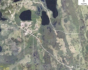
The District is surrounded by the balance of the Harmony DRI, including Harmony High School which is part of the Harmony DRI but is not included within the District boundary. Route 192 runs along the southern boundary of the District. Buck and Cat Lakes serve as the northern boundary of the District, and their contributory wetlands define the eastern and western boundaries of the District. Click here to view the District Boundary Map.
District Infrastructure

Summary of Infrastructure Improvements
The infrastructure improvements of the District include the following:
- Roadways
- Alleys & Sidewalks
- Water, Wastewater, & Electrical Facilities
- Stormwater Management Facilities
- Landscape & Hardscape
- Recreation & Parks
Roadways
The roadways within the District consist of 4-lane divided, 2-lane divided, and 2-lane individual sections. These roadways were designed as collector roadways serving the individual development tracts within the District. The Developer constructed these roadways and conveyed the improvements to Osceola County from back of curb to back of curb. The sidewalks and bikeways constructed adjacent to the roadways are conveyed to and owned by the District (see maintenance stipulations listed below).
Roadways consist of a sub-grade, lime-rock base, curbing, striping, and signage in conformance with the Land Development Regulations of Osceola County. There were approximately 5 miles of collector roadways initially constructed in the District, with more added as each of the new neighborhoods was developed. Once conveyed, the County took ownership and is responsible for the perpetual care and maintenance of the roads.
Sidewalks & Alleyways
In those neighborhoods that have them, alleyways are maintained by the District.
Sidewalk maintenance in all 1st & 2nd phase Harmony neighborhoods (i.e., Town Center [TC], Ashley Park [A1], Birchwood [B], Cypress 1&2 [C1 & C2], Drake 1&2 [D1 & D2], The Estates [E], Green [G], and Rosewood [H1]) is a shared responsibility between the homeowner and the District.
In 3rd & later phase neighborhoods (viz., Cherry Hill [F], Hawthorne [H2], The Lakes [I, J, K, & L {South, East, North, & West}], Waterside [O], & future neighborhoods), sidewalk maintenance is the responsibility of the Road & Bridge Office of the Osceola County Department of Public Works.
Appearance maintenance of the sidewalks along the front and side of a property is the responsibility of the owner. Appearance maintenance of the walkways not adjacent to a residence is the responsibility of the District. Structural integrity maintenance of all sidewalks and walkways throughout the community is the responsibility of the District (except in F, H2, I, J, K, L, O, and future neighborhoods [as noted above]).
Appearance maintenance consists of sweeping and mold and mildew removal (via power washing and/or chemical application). Structural maintenance consists of elevated edge grinding, cracked edge or corner repair, and defective slab replacement, as needed.
Water, Wastewater, & Electrical Facilities
 This
infrastructure consists of potable water mains, along with wastewater gravity mains & force mains, lift stations, effluent reuse & irrigation mains, & underground electrical cables.
These facilities were constructed in accordance with Land Development Regulations of Osceola County,
the Florida Department of Environmental Protection (FDEP), the South Florida Water Management District (SFWMD), &
the Harmony DRI Development Orders in effect at time of construction.
The potable water system includes all the necessary valving, fire hydrants, and individual services to serve individual lots and development parcels. The system design provides for both domestic demand and fire flow. Approximately 5 miles of water mains were constructed initially, with more added as other neighborhood parcels were developed.
The wastewater infrastructure includes the gravity lines, force main, lift station, and individual lot services sufficient to serve all individual lots and development parcels in the District. Approximately 3.7 miles of gravity lines, 3.2 miles of force main, & 3 lift stations were constructed initially. More were added as each parcel was developed.
An effluent reuse system was constructed to serve as the primary irrigation system for the project. Highly treated effluent is discharged from the wastewater plant into a hydro-pneumatic tank. Over 5 miles of effluent reuse mains, including the valving and individual services to individual lots and development parcels, have been constructed. Treated effluent is supplemented with stormwater & groundwater to satisfy the irrigation demands throughout the District.
Once the construction for a parcel is completed, the water, wastewater, and effluent water systems are conveyed to the Toho Water Authority utility system for perpetual operation and maintenance.
 Electrical
cabling was constructed adjacent to all collector roadways sufficient for service to all individual lots and development parcels. Street lighting is also included along the collector roadways.
Areas north of Route 192 (encompassing the entirety of Harmony CDD) are located within Orlando Utilities Commission (OUC) service region.
Areas south of Route 192 (which includes Harmony High School) are located within the service region of Duke Energy Florida (formerly known as Progress-Energy/Florida-Power Corporation).
Stormwater Management Facilities
A master stormwater system was constructed in accordance with the requirements of the SFWMD, Osceola County, and applicable DRI Development Orders. This system consists of interconnected wetland retention/detention ponds, which were designed as unfenced project amenities. Stormwater runoff from a development parcel is routed via a secondary drainage system into the retention/detention ponds. These ponds ultimately discharge into adjacent & nearby wetlands throughout the District. Design criteria include meeting water quality and quantity criteria, as well as providing for compensating storage for any development within the 100-year floodplain areas.
The stormwater and drainage systems are overseen and maintained by the District.
Click here to view the Planned Master Drainage System Map.
Click here to view the Ponds Layout & Drainage System Map.
{High resolution graphics — zoom-in to see details.}
Landscape & Hardscape
Landscape & hardscape are provided along the project collector roadways, the project entrance on Route 192, throughout Town Center, and within the park & recreation areas. Xeriscape landscaping is emphasized throughout to minimize irrigation water demands and to maintain a natural look within the community. Wherever possible, existing or other native vegetation is employed.
Recreation & Parks
 The District provides & maintains parks located throughout the various neighborhoods.
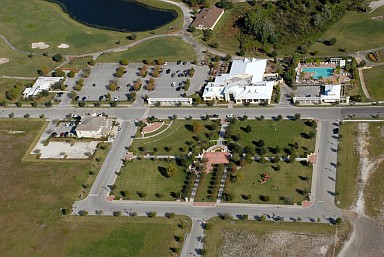
Notable among these are the Harmony Square (Town Center) Park, the Swim Club at Harmony Square, the Dog Park on Cat Brier Trail, Long Park along the edge of the front & back nine holes of the Harmony Golf Preserve, Lakeshore Park along the tree line of Buck Lake, & Linear Park along the north side of Butterfly Drive.
These parks provide picnic facilities, children's playgrounds, and passive recreation.
The District also owns & operates boats that are available to Harmony residents at Lakeshore Park, and Harmony residents are able to enjoy Buck Lake and its lakeshore facilities pursuant to an inter-local ownership and maintenance agreement between the Districts of Harmony Main and Harmony West.


